Trying to make sense of Orinda’s neighborhoods? You are not alone. This small city packs several lifestyles into a few square miles, from walkable village blocks to private ridge homes with sweeping views. If you want transit access, outdoor space, or a quieter setting, each pocket offers different tradeoffs. In this guide, you will learn how the main areas of Orinda line up with daily life, commute needs, lot types, and common ownership considerations. Let’s dive in.
How Orinda is organized
Orinda sits along Highway 24 between Lafayette and Moraga. Many buyers choose it for access to Oakland and Berkeley and the convenience of the Orinda BART station. The layout mixes a compact town core with neighborhoods that spread into hills, ridges, and larger-lot areas.
Neighborhood labels in Orinda are commonly used by locals and agents, but borders are not always official. When you focus on a specific address, verify details with city and county maps. You will also find a range of home types, from early cottages and mid-century ranches to custom hillside builds and newer infill near the core.
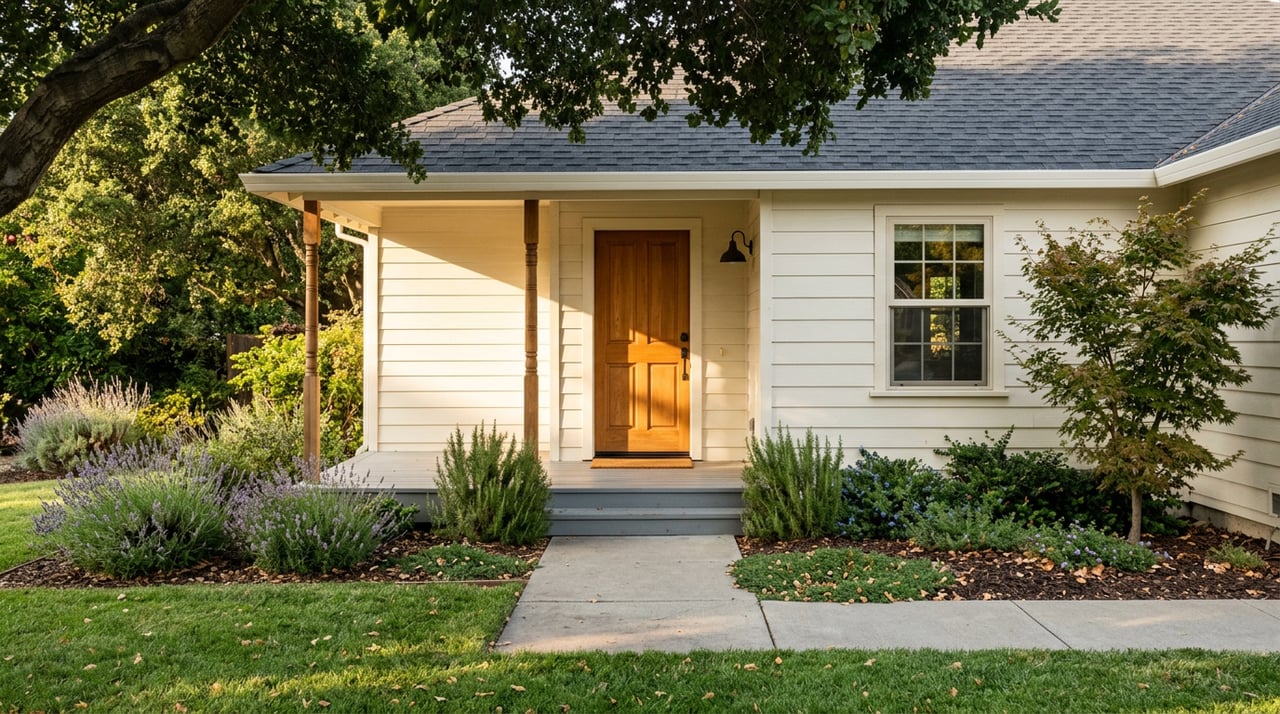
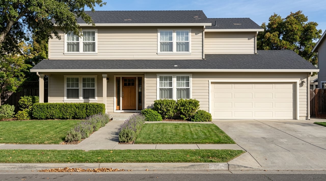
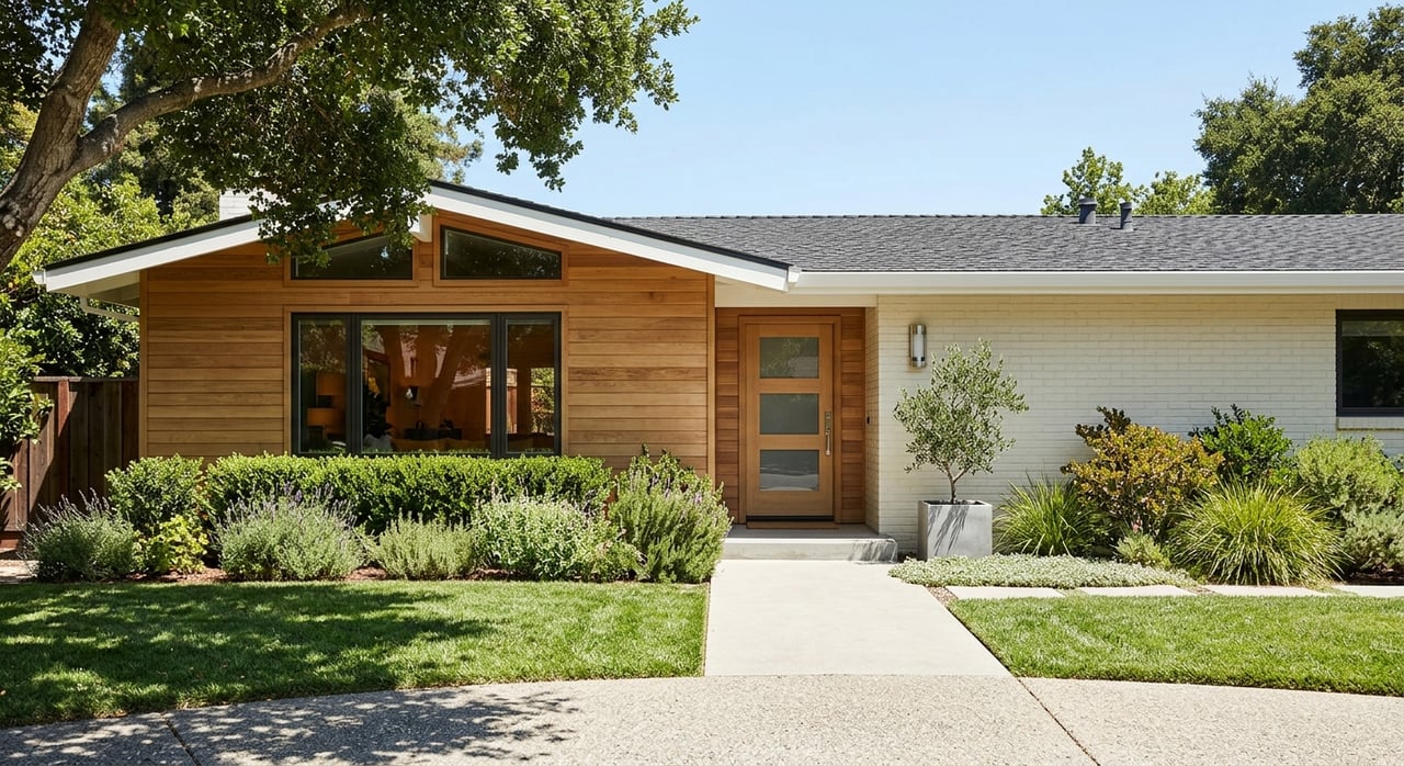
Orinda Village and Downtown
This is the most walkable part of town. The Orinda Theatre, small shops, restaurants, and everyday services cluster near the BART station. If you want to cut down your car time, the village puts errands and transit close by.
- What you will find: Smaller single-family houses, townhomes, some cottage or bungalow-style homes, and a few low-rise condos or newer infill near the core.
- Lots and layout: Generally smaller, more level lots, with a denser street grid than the hills. On-street parking is common. Many homes have detached or attached garages.
- Access and commute: Immediate reach to BART and Highway 24 without a long drive to park and ride.
- Ownership notes: Expect older building stock in places. Plan for checks on roof condition, sewer laterals, and seismic or system upgrades. If you have multiple vehicles, review any neighborhood parking limits and practical street parking.
BART-adjacent neighborhoods
Areas up and down Camino Pablo and nearby streets sit within walking or a short drive to the station. These locations are popular with commuters who want flexibility between public transit and Highway 24.
- What you will find: A mix of post-war ranches, mid-century homes, and some townhomes or condos. Many were built with commuter life in mind.
- Lots and layout: Moderate lot sizes, often less steep than the far hills.
- Access and commute: High convenience for BART riders and those who want to avoid the heaviest freeway congestion.
- Ownership notes: Proximity to transit is a plus, but you may see smaller yards and more transitional zoning. Check sidewalk and curb conditions and consider everyday noise levels near the station or main routes.
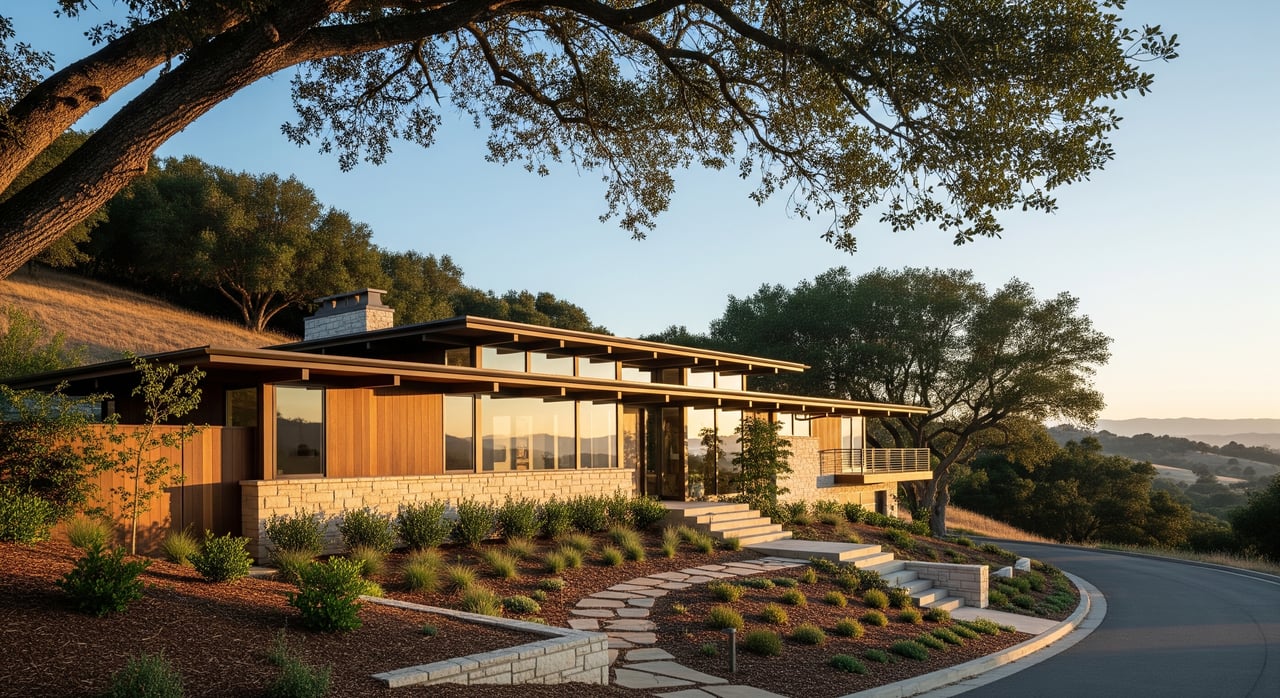
Hillside and ridge homes
Hillside and ridgeline parcels trade walkability for privacy, views, and a strong sense of place. Architecture ranges from mid-century designs to custom moderns that take advantage of elevation and outlooks.
- What you will find: Custom and architect-designed homes mixed with remodeled mid-century properties. Many are two stories to capture views.
- Lots and layout: Steep slopes, terraced yards, and varied parcel shapes are common. Expect retaining walls, engineered drainage, and driveways that can be narrow or steep.
- Access and commute: Daily errands usually require a car. Trails and open spaces are often closer.
- Ownership notes: Slope, drainage, and retaining-wall condition are critical. Ask for permits or documentation on any slope stabilization or major structural work. Fire safety also matters since many ridges are closer to wildland vegetation; plan for defensible space and ongoing vegetation management.
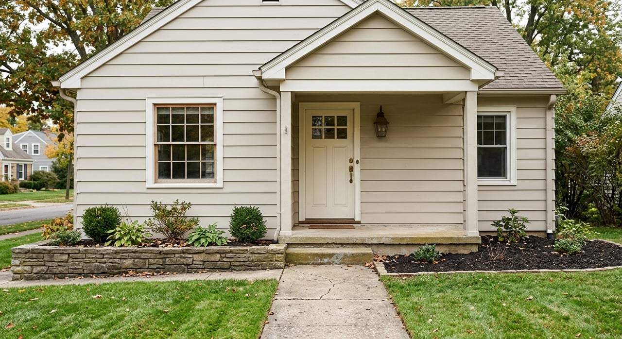
Sleepy Hollow and semi-rural large-lot pockets
If you want more breathing room and a semi-rural feel, parts of Orinda offer larger parcels with mature trees and separation between homes. These areas feel tucked away while still close to town.
- What you will find: Larger ranches, custom homes, and properties with substantial yards. Some pockets include equestrian-style layouts.
- Lots and layout: Bigger, irregular parcels, mature landscapes, private driveways, and at times private roads.
- Access and commute: Fewer walkable destinations. Expect longer internal drives to reach downtown or BART.
- Ownership notes: Confirm private road maintenance obligations, including how costs are shared. Utilities are typically municipal inside city limits, but verify if any parcel uses private systems. Keep up with defensible space and brush management.
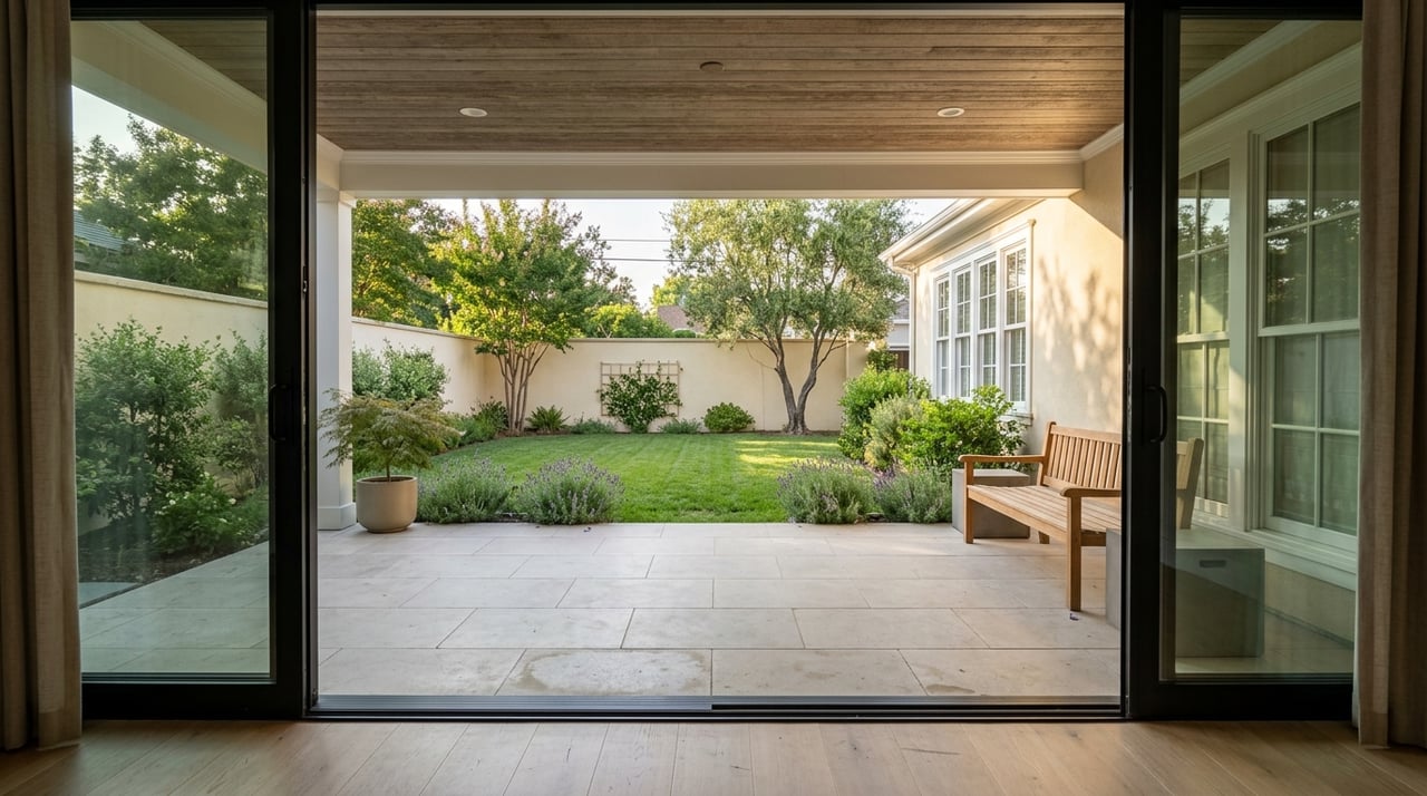
Subdivision and mid-century pockets, including Glorietta
Planned neighborhoods give you a more consistent suburban feel. Streetscape patterns and lot sizes tend to match from block to block, and you may be closer to schools and parks.
- What you will find: Mid-century ranches and split-level homes, plus remodels, replacements, and occasional new infill.
- Lots and layout: Moderate, more uniform yards with typical setbacks and city services.
- Access and commute: Short drives to Highway 24 or BART. Everyday trips to nearby schools, parks, and local shops are convenient by car.
- Ownership notes: Original homes may still have older mechanicals or windows. Verify permitted additions, decks, or conversions to understand accurate square footage and compliance.
Buyer checklists that vary by pocket
Hazard and site condition checks
- Wildfire exposure. Review local guidance and mapping. Properties near ridges or heavier vegetation often require defensible space and ember-resistant features.
- Flood risk. Check proximity to creeks like San Pablo Creek and confirm any floodplain designation.
- Landslide and soils. In hillside areas, review geologic context and any history of slope movement or repairs.
- Trees and vegetation. Orinda has many mature heritage trees. Learn about local ordinances before removal or major trimming.
Infrastructure and utilities
- Private roads. Confirm maintenance agreements, cost sharing, and recent assessments if a property sits on a private road or shared driveway.
- Sewer and water. Most homes are on municipal systems. Verify service for larger or edge parcels and confirm sewer lateral status.
- Easements. View, access, and utility easements can affect how you use the lot or plan future improvements.
Inspections for hillside or older homes
- Structural and site features. Evaluate retaining walls, foundation, and drainage design. Ask about engineered upgrades.
- Systems and safety. Check roof age, plumbing and electrical updates, seismic bolting, and chimney bracing.
- Permits and reports. Pull building records to confirm major work, additions, and decks. For steep lots, look for geotechnical reports.
Insurance and financing
- Coverage availability and cost. Wildfire and landslide exposure can affect insurance options and premiums. Start quotes early when a property sits in a higher-risk zone.
- Lender requirements. Steep sites or significant retaining walls may trigger requests for engineering or additional reports.
Verify property facts with public tools
Use these resources to confirm parcel-level details before you write an offer or during contingencies:
- City of Orinda planning and building pages for zoning, permits, and local ordinances. Start with the official site at the City of Orinda website: City of Orinda.
- County parcel and records research, including assessor data and recorded easements, through Contra Costa County’s official portal.
- Wildfire hazard context using CAL FIRE’s public resources for Very High Fire Hazard Severity Zone maps and local guidance on defensible space.
- Flood risk mapping via the FEMA Map Service Center to review Flood Insurance Rate Maps and lender requirements.
- Landslide and geologic context on USGS, which provides regional geologic mapping helpful for hillside due diligence.
- Transit planning and station details at BART to understand walk times, parking options, and schedule planning.
- School attendance verification using district tools. Check boundaries and school information with the Orinda Union School District and the Acalanes Union High School District. Always confirm the exact parcel’s assignment before relying on a neighborhood label.
Matching a pocket to your daily life
As you narrow your search, think through a typical week. Do you want to walk to coffee and hop on BART, or would you rather enjoy a quiet hillside deck and drive in for errands? Are you comfortable with routine slope and vegetation maintenance, or do you prefer a level yard that is easier to manage? These are all valid choices. The right pocket is the one that fits your commute, your daily rhythm, and your comfort with site care.
If you are weighing several addresses, a quick comparison helps. Note the lot type and slope, distance to Highway 24 and BART, street parking or driveway access, and any private road responsibilities. Then layer in hazard mapping, permit history, and your insurance quotes. You will see the tradeoffs clearly and can move forward with confidence.
Ready to explore homes by pocket, map out commute times, and verify property-specific details together? Reach out to Jeff Snell for local guidance, a customized search, and a clear plan for inspections and due diligence.
FAQs
What parts of Orinda are considered “downtown,” and how close are they to BART?
- The village and blocks surrounding the Orinda Theatre and retail core are the most walkable to the station, with quick access to trains and Highway 24.
How do I check wildfire risk for an Orinda property?
- Review state hazard designations using CAL FIRE’s public maps and then confirm local defensible space requirements through city resources.
How can I confirm which schools serve a specific Orinda address?
- Use attendance boundary tools from the Orinda Union School District and Acalanes Union High School District and verify the exact parcel, not just the neighborhood name.
What should I prioritize when inspecting a hillside home in Orinda?
- Focus on slope stability, retaining walls, engineered drainage, permit history for any stabilization, and insurance quotes based on location and site features.
Are private roads common in Orinda’s large-lot areas, and what should I ask for?
- Yes in some pockets. Request recorded maintenance agreements, recent invoices, and clarity on cost sharing for repairs or resurfacing.
How do I evaluate flood risk near creeks like San Pablo Creek?
- Check FEMA flood maps for the parcel, confirm any lender requirements, and consider local runoff patterns in addition to mapped floodplains.